30Mar/25

SkyeyeUAV V-Series VTOL Fixed-Wing UAVs: Comprehensive Overview and Comparison

SkyeyeUAV offers a range of high-performance VTOL fixed-wing UAVs designed for long endurance, high payload capacity, and superior reliability. Among them, V series VTOL UAVs are the bestsellers with their excellent performance and most competitive prices. These UAVs are widely used in aerial surveying, mapping, surveillance, cargo transport, and industrial inspections. Below is an overview of our UAV models, followed by a detailed comparison table to help customers choose the right platform for their needs.

V-Series UAV Model Overview

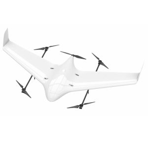
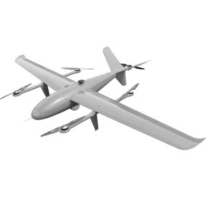
V21 – Flying Wing VTOL Fixed-Wing UAV

Applications: Aerial mapping, environmental monitoring, and reconnaissance missions.

Performance Specifications:

  • Flight Time: 120 minutes (empty load)
  • Maximum Takeoff Weight: 10kg
  • Safe Payload: 1.2kg
  • Wingspan: 2.15m
  • Fuselage Length: 0.93m
  • Wind Resistance: Level 5-6
  • Power System: Battery

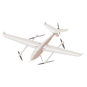
V25 – VTOL Fixed-Wing UAV (2.5m)

Applications: Agricultural surveying, powerline inspection, and security surveillance.

Performance Specifications:

  • Flight Time: 3 hours 40 minutes
  • Maximum Takeoff Weight: 13.5kg
  • Safe Payload: 1.2kg
  • Wingspan: 2.5m
  • Fuselage Length: 1.26m
  • Wind Resistance: Level 5-6
  • Power System: Battery

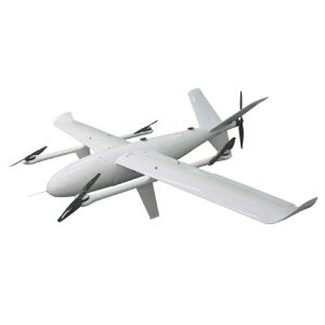
V32 – VTOL Fixed-Wing UAV (3.2m)

Applications: Logistics, large-area mapping, and emergency response.

Performance Specifications:

  • Flight Time: 4 hours (empty load)
  • Maximum Takeoff Weight: 24.5kg
  • Safe Payload: 1-5kg
  • Wingspan: 3.2m
  • Wind Resistance: Level 5-6
  • Power System: Battery

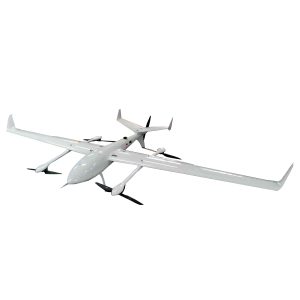
V35 – VTOL Fixed-Wing UAV (3.5m)

Applications: Heavy payload delivery, surveillance, and long-range reconnaissance.

Performance Specifications:

  • Flight Time: 160 minutes (with 7kg payload)
  • Maximum Takeoff Weight: 26.5kg
  • Safe Payload: 5-10kg
  • Wingspan: 3.5m
  • Wind Resistance: Level 5-6
  • Power System: Battery

V39 – VTOL Fixed-Wing UAV (3.9m)

Applications: Border patrol, large-area monitoring, and industrial applications.

Performance Specifications:

  • Flight Time: 4.5 hours (empty load)
  • Maximum Takeoff Weight: 32kg
  • Safe Payload: 6-12kg
  • Wingspan: 3.9m
  • Wind Resistance: Level 6-7
  • Power System: Battery

V-series UAV Model Comparison Table

Parameter V21 V25 V32 V35 V39
Picture SkyeyeUAV V21 Delta VTOL Drone SkyeyeUAV V25 VTOL Drone SkyeyeUAV V32 VTOL Drone SkyeyeUAV V35 VTOL Drone SkyeyeUAV V39 VTOL Drone
Wingspan 2.15m 2.5m 3.2m 3.5m 3.9m
Flight Time (Empty) 2h 4h 20m 4.5h 2h 50m w/5kg payload 4.5h
Typical Flight Time 90m w/ 1.5kg 3h w/ 2kg 3h w/ 3kg 2h 50m w/ 5kg 3h 50m w/ 5kg
Max Takeoff Weight 10kg 13.5kg 24.5kg 26.5kg 32kg
Safe Payload 1.2kg 2.5kg 1-5kg 5-10kg 1-5kg
Wind Resistance Level 5-6 Level 5-6 Level 5-6 Level 5-6 Level 6-7
Power System Battery Battery Battery Battery Battery
Price (Airframe Only) US$2,999.00 US$4,679.00 US$6,999.00 US$7,999.00 US$8,999.00
Price (PNP) US$7,999.00 US$9,999.00 US$14,999.00 US$16,999.00 US$18,499
Price (RTF) US$12,999.00 US$14,999.00 US$19,999.00 US$21,999.00 US$23,499.00

* Please note due to current China’s export control regulations on drone products, the RTF versions can be sold within China’s mainland only.

Key Features of SkyeyeUAV V-Series VTOL UAVs:

  • Advanced Materials: Carbon fiber, fiberglass, and Kevlar construction for durability and lightweight performance.
  • Modular Design: Easy maintenance and replacement of parts for extended usability.
  • Tool-Free Assembly: Patented quick-release connectors for rapid deployment.
  • High-Efficiency Power System: Optimized battery and propulsion for maximum endurance.
  • Redundant Power Design: Ensures enhanced flight safety and reliability.
  • Custom Payload Support: Designed to accommodate various payloads, including mapping sensors, surveillance cameras, and cargo modules.

SkyeyeUAV’s VTOL UAVs are ideal for professional applications requiring long endurance, high payload capacity, and superior reliability in diverse operational environments.

26Mar/25

In-Depth Analysis of Ukraine’s Liutyi Drone

Keywords: Liutyi drone, AN-196 Liutyi, Ukrainian unmanned aerial vehicle, UAV development, drone warfare, Ukrainian drone strikes

The AN-196 Liutyi, translating to “fierce” or “furious” in Ukrainian, is a domestically developed long-range attack unmanned aerial vehicle (UAV) introduced by Ukroboronprom in October 2022. Designed to counter the Russian deployment of Iranian-made Shahed-136 drones, the Liutyi has played a pivotal role in Ukraine’s strategic operations, targeting critical infrastructure within Russian territory.

Development History

In response to Russia’s utilization of Shahed-136 drones during the invasion of Ukraine, Ukroboronprom announced the development of the Liutyi in October 2022. The objective was to create a UAV capable of delivering a 75 kg warhead over distances exceeding 1,000 kilometers. Despite initial skepticism due to its substantial size and radar signature, the Liutyi has proven its efficacy in operational scenarios.

The development faced several challenges, including competition with established UAVs like the Bayraktar TB2, limited domestic manufacturing capabilities for long-range drones, and funding constraints. The initial prototype was self-funded by model enthusiasts and encountered numerous obstacles due to a lack of components. The first prototype was completed in the autumn of 2022, with its maiden flight on October 22, 2022. Despite a crash during a test flight in December 2022, the durable electronics allowed for repairs, and the drone returned to the skies within three days.

The first prototype of Liutyi UAV

The first prototype of Liutyi UAV

A notable incident occurred in late April 2023 during a trial aimed at attacking Snake Island. The Liutyi drone lost remote control and, carrying 50 kg of explosives, inadvertently headed towards its own flight control center. The situation was resolved when operators regained control approximately 30 kilometers from the coast.

Technical Specifications

  • Type: Loitering munition

  • Weight: 250–300 kilograms

  • Length: 4.4 meters

  • Wingspan: 6.7 meters

  • Warhead Weight: 50–75 kilograms

  • Engine: Four-valve air-cooled boxer engine

  • Range: 1,000–2,000 kilometers

  • Guidance System: Artificial intelligence, satellite navigation, and inertial navigation system

These specifications endow the Liutyi with the capability to conduct deep strikes with high precision, making it a formidable asset in Ukraine’s military arsenal.

The drone’s propulsion system includes a gasoline engine with a three-blade propeller mounted at the rear, allowing for a heavy explosive payload in the nose. Its modular design facilitates easy disassembly, transport, and maintenance, and it can be launched from various locations, including roads, enhancing its operational flexibility.

Operational Use and Impact

Since its deployment, the Liutyi drone has been instrumental in Ukraine’s offensive operations, particularly in targeting Russian oil refineries and industrial facilities. Notably, on November 25, 2024, a Liutyi drone equipped with an upgraded 75 kg warhead successfully struck the Saratov Oil Refinery, located over 600 kilometers from the Ukrainian border. Reports indicate that the Liutyi is responsible for approximately 80% of successful Ukrainian drone strikes on Russian oil facilities, underscoring its operational effectiveness.

The integration of artificial intelligence in the Liutyi’s guidance system has enhanced its precision and resilience against electronic warfare measures. This technological advancement has significantly disrupted Russian oil production, with estimates suggesting that 12–14% of Russia’s refining capacity has been rendered offline due to these drone strikes.

The first successful strike by the Liutyi drone targeted an oil depot inside Russian territory.

The first successful strike by the Liutyi drone targeted an oil depot inside Russian territory.

In March 2025, Ukrainian An-196 Liutyi long-range kamikaze drones attacked the 333rd combat training center near Mulino in the Nizhny Novgorod region, a facility equipped with modern electronic training equipment and a large proving ground for conducting mock battles.

Liutyi Drone: Advanced Navigation Capabilities with Skynode S

The Liutyi drone, developed by Ukraine’s defense industry, has demonstrated remarkable effectiveness in navigating complex routes to evade Russian air defenses. This capability is largely attributed to the integration of the Skynode S universal machine vision system, developed by the American company Auterion in collaboration with U.S., EU, and Ukrainian governmental and industry partners.

Skynode S is an all-in-one flight control and mission computing solution that enables drones to operate autonomously, even in environments with degraded or jammed GPS signals. By employing advanced machine vision algorithms, Skynode S allows drones to compare real-time visual data with high-resolution satellite maps, facilitating precise navigation over long distances without reliance on satellite navigation.

This technology significantly enhances the drone’s ability to execute complex flight paths, effectively avoiding radar detection and electronic warfare countermeasures. The implementation of Skynode S has reportedly increased mission success rates from 20% to over 90%, underscoring its critical role in modern drone operations.

Furthermore, Skynode S supports swarm control and fully autonomous flight, providing drones like the Liutyi with unprecedented accuracy and operational flexibility. Its open architecture facilitates seamless integration into various unmanned aerial systems, making it a versatile solution for enhancing drone capabilities in contested environments.

Skynode S is an all-in-one flight control and mission computing solution that enables drones to operate autonomously, even in environments with degraded or jammed GPS signals.

Skynode S is an all-in-one flight control and mission computing solution that enables drones to operate autonomously, even in environments with degraded or jammed GPS signals.

The integration of Skynode S into the Liutyi drone exemplifies the synergy between Ukrainian defense initiatives and international technological advancements, resulting in a formidable asset capable of precise and resilient operations in complex combat scenarios.

The development and deployment of the Liutyi drone exemplify Ukraine’s commitment to advancing its indigenous defense capabilities. Its success in executing strategic strikes deep within enemy territory highlights the evolving nature of drone warfare and its profound impact on modern conflicts.
22Mar/25

Long-Range Drone Warfare: Analyzing Ukraine’s 2025 Raids

On January 14, 2025, the General Staff of the Ukrainian Armed Forces confirmed a large-scale strike against Russian military targets deep within its territory, including oil storage bases and military production facilities located 200–1,100 kilometers from the frontlines. Despite limitations in the destructive power of Ukraine’s existing long-range attack drones due to payload constraints, their systematic deployment since 2024—combined with U.S.-supplied weaponry—has inflicted measurable damage on critical Russian rear-area installations. The operational use of massed long-range drones and the defensive vulnerabilities exposed during these attacks warrant close attention from military strategists.


I. Ukrainian Attack Details

Between late January 13 and early January 14, 2025, Ukrainian forces conducted coordinated drone strikes against targets in Russia’s Bryansk, Saratov, Tula regions, and the Republic of Tatarstan. The following table summarizes the attacks from January 13–16:

Date/Time Target Damage Assessment
Jan 13 (Night) – Jan 14 Alekseevsky Chemical Plant (Tula Oblast) Fire caused by Security Service of Ukraine (SBU) drones
Engels Airbase (Saratov Oblast) Sustained blaze at ammunition depot storing glide bombs and cruise missiles
Saratov Oil Refinery Major infrastructure fire post-strike
Bryansk Chemical Plant Direct missile hit triggered explosions (produces rocket fuel/ammunitions for Russian military)
Jan 16 Kuzmino-Gat Gunpowder Factory (Tambov Oblast) Damage unconfirmed (located ~450 km east of Russia-Ukraine border)
Voronezh Oil Depot Fire ignited by drone payload

Key Observations:

  • Ukraine intensified systematic attacks on military-industrial facilities supporting Russia’s war effort, notably through repeated strikes on the Kristall oil storage facility in Saratov.
  • The January 13 strikes in southwestern Russia destroyed two air defense systems (Tor and Buk) and ignited fires at the Bryansk Chemical Plant, a critical rocket fuel production site.
  • While individual drone payloads limited single-strike lethality, cumulative damage from sustained attacks risks degrading logistical capabilities and forcing resource reallocation for rear-area defense.

II. Analysis of Ukrainian Long-Range Drone Deployment

(1) Probable Drone Models

Though unconfirmed, Ukraine likely utilized the following drones with ~50 kg payloads and extended ranges:

Liutyi Drone

  • Range: 1,000 km
  • Cost: ~$200,000 per unit
  • Features:
    • Aerodynamic design resembling Turkey’s Bayraktar TB2 (low fuel consumption)
    • Lightweight fiberglass airframe
    • Hybrid guidance system (autonomous and manual modes)
    • Modular assembly for rapid deployment

UJ-22/UJ-26 Drones (UkrJet)

  • Range: 800 km
  • Capabilities:
    • Winged design for extended loitering
    • Precision strikes on static targets
Liutyi UAV with modular warhead design

Liutyi UAV with modular warhead design

(2) Tactical Employment

A. Swarm Attacks

  • Mechanics: 10–15 Liutyi drones assault a single target sequentially or simultaneously.
  • Warhead Effectiveness: Blade-fragment payloads (shown below) enhance structural damage through forced fragmentation.
Liutyi Warhead recovered by Russian forces

Liutyi Warhead recovered by Russian forces

B. Decoy Coordination

  • Tactic: Use drones to saturate Russian air defenses, followed by ATACMS missile strikes on high-value targets.

III. Lessons for Drone Warfare & Defense

(1) Offensive Takeaways

  • Integrated Tactics: Combine drone swarms with NATO-supplied missiles to exploit gaps in limited air defense coverage.
  • Timing: Night/dawn attacks complicate detection and interception.

(2) Defensive Vulnerabilities

  1. Inadequate Reconnaissance:
    • Russia’s optical/SAR satellites lack coverage and resolution parity with Western systems.
  2. Resource Constraints:
    • Advanced detection systems are prioritized for frontline use, leaving rear areas exposed.

Recommendations:

  • Enhance 24/7 surveillance networks and electronic warfare capabilities.
  • Study adversarial drone production scales, deployment patterns, and countermeasure strategies.
14Mar/25

How Drone Delivery is Reshaping Global Supply Chains?

Sky Wars: Technological Breakthroughs in Drone Delivery

In September 2023, a drone carrying 1.2 tons of cargo flew from Shenzhen to Hengqin Island in Zhuhai, completing the world’s first cross-sea container transport. This 47-minute flight marked the official entry of logistics drones into the era of “heavy-duty, long-distance” operations.

Technical parameters that defy conventional understanding:

  • Payload Capacity: The SF Express FH-98 drone has a maximum payload of 1.5 tons, equivalent to three adult polar bears.
  • Range Revolution: Hydrogen fuel cells have extended flight ranges beyond 1,000 kilometers, surpassing the direct distance between Beijing and Shanghai.
  • Intelligent Evolution: Equipped with millimeter-wave radar and AI vision systems, these drones can detect and automatically avoid power lines as thin as 0.5mm in diameter.

Source: Civil Aviation Administration of China’s “2023 Civil Unmanned Aerial Vehicle Development White Paper”

In the cliffside village of Liangshan, Sichuan, JD’s drones complete 37 takeoffs and landings daily, precisely delivering medicines and textbooks to 20cm-square receiving platforms. Once famous for its “sky ladders,” this village has become a classic case of drones solving the “last mile” delivery challenge.

Cost Disruption: How Drones are Redefining Logistics Economics

In traditional logistics models, delivery costs to certain villages in Nagqu, Tibet, reached up to 48 yuan per package, with 83% of the cost consumed by the 80 kilometers of mountainous roads between the county and the village. After Meituan launched drone delivery routes, the cost per package plummeted to 6.7 yuan.

A transformative restructuring of cost components:

Cost Item Traditional Delivery Drone Delivery Reduction Rate
Labor Costs 58% 9% 84.5%
Fuel/Electricity 22% 63%
Vehicle Depreciation 15% 5% 66.7%
Accident Compensation 5% 0% 100%

Source: Deloitte’s “2023 Global Smart Logistics Report”

In Shenzhen, SF Express’s “Fengyi ARK40” drone fleet has taken over 27% of the city’s urgent medical supplies delivery. These drones, equipped with thermostatic blood boxes and defibrillators, have reduced the emergency response time for acute myocardial infarction patients from 52 minutes to 19 minutes.

Airspace Dominance: The Global Drone Logistics Triumvirate

  • China: Holding 87% of the world’s logistics drone patents, China plans to build 200,000 drone airports by 2025, forming a “15-minute county-level response circle.” JD’s “Jingting” drone has even secured orders from the Philippine government to establish an aerial logistics network across its 7,000 islands.

  • United States: Amazon’s Prime Air, through special FAA permissions, has achieved 24/7 commercial operations in Texas. Its MK30 model features a “sound camouflage system,” reducing flight noise to the level of an air conditioning unit.

  • Rwanda: This small African nation, leveraging Zipline’s drone blood bank network, has reduced maternal hemorrhage mortality rates by 88%. With 150 drones traversing between volcanoes and lakes daily, Rwanda has become the “world’s first drone logistics sovereign nation.”

Dark Challenges: The Five Deadly Hurdles to Drone Proliferation

  1. Battery Curse: Current lithium battery energy density is only 300Wh/kg. Achieving a 500kg payload with a 500km range requires breakthrough battery technology. CATL’s development of condensed matter batteries may be a game-changer.

  2. Airspace Conflict: Although airspace below 120 meters has been opened, drones’ overlap with civil aviation routes reaches 37%. Shanghai’s testing of an “urban air traffic management system” aims to use blockchain technology to achieve real-time scheduling for millions of drones.

  3. Electromagnetic Interference: In 2023, Shenzhen experienced a mass drone crash due to electromagnetic interference from a substation. Emerging quantum communication technology may be key to resolving this issue.

  4. Hacker Threats: Laboratory tests show that a 200-yuan signal jammer can cause drones to lose control. Military-grade encryption chips are becoming standard in logistics drones.

  5. Social Resistance: The International Transport Workers’ Federation (ITF) has launched protests in 40 countries, accusing drones of putting 1.5 million jobs at risk.

Future Vision: The Aerial Logistics Network of 2040

The “Future Logistics White Paper” released by Cainiao Network envisions the following scenario:

  • Urban Skies: At an altitude of 300 meters, 12 layers of airways are designated for cargo drones, flying cars, and sightseeing helicopters, each operating in separate layers.

  • Transit Hubs: Vertical takeoff and landing platforms are established every 5 kilometers, equipped with automatic battery swapping systems and cargo sorting robots.

  • Extreme Deliveries: Antarctic research stations, through a combination of Starlink and drones, achieve thrice-weekly fresh food supplies.

The foundation of all this lies in China’s ongoing “low-altitude new infrastructure” initiative—over the next three years, 90 billion yuan will be invested to construct 170,000 drone landing platforms, accompanied by a new air traffic control system.

The “Impossible Triangle” of Drones

In the eternal balance between efficiency, cost, and safety, drones are forging a new equilibrium. As we witness drone swarms dancing with migratory birds over Shenzhen Bay, perhaps it’s time to rethink: this aerial revolution is not only transforming logistics but also redefining the boundaries of human perception of space and time.

22Feb/25

Best Long-Range VTOL Drones 2025: A Comprehensive Review

Long-range Vertical Take-Off and Landing (VTOL) drones have become indispensable in industries requiring extensive aerial coverage and precision, such as agriculture, mining, surveying, and surveillance. These drones combine the versatility of vertical take-off and landing with the efficiency of fixed-wing flight, enabling operations in diverse environments without the need for runways. This article reviews the top long-range VTOL drones available in 2025, focusing on key specifications like flight time, payload capacity, range, and suitability for various applications. The review includes SkyeyeUAV’s Volitation VT370 and Skyeye 5000 VTOL, alongside other notable models, to provide a balanced and informative guide for professionals and enthusiasts.
To compile this list, we evaluated several critical factors to ensure a comprehensive comparison:
  • Flight Time: The duration the drone can remain airborne, directly impacting its coverage area and suitability for long-duration missions.
  • Payload Capacity: The weight the drone can carry, essential for tasks involving heavy sensors, cameras, or delivery payloads.
  • Range: The distance the drone can cover, influenced by both flight time and cruising speed, crucial for remote operations.
  • Ease of Use: User-friendly interfaces, autonomous flight capabilities, and quick deployment features.
  • Durability and Reliability: Build quality, wind resistance, and performance in various environmental conditions.
We included both established brands and emerging manufacturers to offer a diverse range of options, ensuring the list caters to different operational needs and budgets.
Detailed Review of Top Long-Range VTOL Drones
1. Volitation VT370
  • Flight Time: 18 hours with a 5 kg payload, as per user-provided information, making it one of the longest-lasting VTOL drones available.
  • Payload Capacity: 15 kg maximum, suitable for carrying lightweight sensors or cameras for extended missions.
  • Key Features: Exceptional flight endurance, ideal for long-duration tasks such as environmental monitoring, border patrol, or continuous surveillance. Its design leverages aerospace-grade materials for durability.
  • Applications: Perfect for industries requiring prolonged aerial presence, such as agriculture for crop monitoring or security for long-term site surveillance.
Notably, the 18-hour flight time with a 5 kg payload is impressive, surpassing many competitors and highlighting its suitability for extended operations.
2. Skyeye 5000 VTOL
  • Flight Time: 12 hours, based on customer feedback, offering substantial endurance for heavy-lift tasks.
  • Payload Capacity: 25 kg, one of the highest in this review, enabling the carriage of substantial equipment.
  • Key Features: High payload capacity, designed for heavy-duty applications, with robust construction for reliability in demanding environments.
  • Applications: Ideal for large-scale mapping, material transport, or industrial inspections where heavy payloads are necessary, such as in mining or construction.
The Skyeye 5000 VTOL is also well known as Mugin-5 Pro. It’s ability to handle 25 kg payloads while maintaining a 3-hour flight time is noteworthy, catering to industries needing both endurance and heavy-lift capabilities.
3. JOUAV CW-30E
  • Flight Time: 8 hours, providing a balanced duration for professional use.
  • Payload Capacity: 6 kg, suitable for a range of sensors and cameras.
  • Key Features: Offers a good balance between flight time and payload, with features like high-resolution cameras and RTK modules for precise mapping. It is known for its versatility in various environments.
  • Applications: Well-suited for power line inspection, search and rescue, and emergency response, where moderate payload and flight time are sufficient.
  • Source: JOUAV Official Website
The CW-30E’s balanced performance makes it a versatile choice for professionals needing a reliable drone for multiple tasks.
4. T-DRONES VA23
  • Flight Time: 4 hours without payload, reducing to 3 hours with a 1.5 kg payload, based on specifications.
  • Payload Capacity: 2.5 kg, with flight time decreasing as payload increases.
  • Key Features: Features a lightweight carbon fiber frame, quick assembly and disassembly for rapid deployment, and locking propeller design for stability.
  • Applications: Ideal for scenarios requiring quick setup, such as emergency response, temporary surveillance, or short-duration mapping tasks.
  • Source: T-drones Official Website
The VA23’s quick-deployment feature is particularly useful for time-sensitive operations, though its flight time with payload is relatively shorter.
5. MotioNew FLY VTOL
  • Flight Time: 2.5 hours, suitable for shorter missions.
  • Payload Capacity: 1.5 kg, designed for lightweight tasks.
  • Key Features: Compact and lightweight, with a modular design for easy transport and deployment in less than 90 seconds. It combines VTOL capabilities with fixed-wing efficiency.
  • Applications: Best for smaller-scale operations, educational purposes, or tasks like terrain mapping and lightweight material transport.
  • Source: MotioNew Official Website
The FLY VTOL’s compact nature makes it accessible for hobbyists and smaller operations, though its flight time limits its use for long-range tasks.
6. UAVforDrone VTOL
  • Flight Time: 6 hours, offering significant endurance for industrial use.
  • Payload Capacity: 20 kg, one of the highest in this review, enabling heavy-lift operations.
  • Key Features: High flight time and payload capacity, with 100+ km video transmission for long-range surveillance. It is designed for industrial applications with robust construction.
  • Applications: Suitable for large-area mapping, industrial inspections, and long-distance delivery, where both endurance and heavy payload are critical.
  • Source: UAVforDrone Official Website
The UAVforDrone VTOL’s combination of 6-hour flight time and 20 kg payload makes it a strong contender for heavy-duty industrial tasks.
7. DeltaQuad Pro
  • Flight Time: 2.67 hours, based on user-provided information, suitable for shorter, precise missions.
  • Payload Capacity: 3 kg, adequate for lightweight sensors and cameras.
  • Key Features: Known for stability and reliability, with smart technology for autonomous operations. It transitions smoothly between VTOL and fixed-wing modes.
  • Applications: Ideal for inspection, monitoring, and precision tasks where stability and reliability are paramount, such as infrastructure checks or security patrols.
  • Source: DeltaQuad Official Website
DeltaQuad Pro’s focus on stability makes it a reliable choice for critical operations, though its flight time is shorter compared to others.
Comparison and Analysis
To facilitate comparison, the following table summarizes the key specifications of the reviewed drones:
Model
Flight Time
Payload Capacity
Notable Features
SkyeyeUAV VT370
18 hours (5 kg)
5 kg
Longest flight time, ideal for extended missions
SkyeyeUAV Skyeye 5000 VTOL
12 hours
25 kg
Highest payload capacity, suitable for heavy-lift tasks
JOUAV CW-30E
8 hours
6 kg
Balanced performance, versatile for professional use
T-DRONES VA23
4 hours (no payload), 3 hours (1.5 kg)
2.5 kg
Quick deployment, good for rapid response
MotioNew FLY VTOL
2.5 hours
1.5 kg
Compact and lightweight, suitable for smaller tasks
UAVforDrone VTOL
6 hours
20 kg
High flight time and payload, ideal for industrial applications
DeltaQuad Pro
2.67 hours
3 kg
Stable and reliable, perfect for precision tasks
This table highlights the trade-offs between flight time and payload capacity, with Volitation VT370 excelling in endurance and Skyeye 5000 VTOL leading in payload capacity.
Choosing the right long-range VTOL drone depends on specific operational needs. For missions requiring extended flight times, such as continuous monitoring or long-term surveillance, SkyeyeUAV’s Volitation VT370 is unparalleled with its 18-hour flight time. For heavy-lift tasks, such as large-scale mapping or material transport, SkyeyeUAV’s Skyeye 5000 VTOL and UAVforDrone VTOL are top choices due to their high payload capacities. JOUAV’s CW-30E offers a balanced solution for general professional use, while T-DRONES VA23 and MotioNew FLY VTOL cater to more specific or smaller-scale requirements. DeltaQuad Pro ensures reliability and precision for critical tasks like infrastructure inspection.
By understanding the strengths and applications of each drone, users can make informed decisions to maximize their investment and operational efficiency, ensuring they select the most suitable model for their specific needs and requirements.
21Feb/25

Heven Drones Unveils Hydrogen-Powered ‘Raider’ UAV at IDEX 2025

Heven Drones, an Israeli drone manufacturer, has announced the debut of its latest hydrogen-powered unmanned aerial vehicle (UAV), the “Raider,” at the International Defence Exhibition (IDEX) in the United Arab Emirates. This unveiling marks a significant advancement in long-range drone technology, offering both military and civilian sectors a cleaner and more sustainable flight option.

The Raider UAV features vertical takeoff and landing (VTOL) capabilities and boasts an impressive flight endurance of up to 1,000 kilometers. Designed with a dual-fuselage structure, it is equipped with four rotors for VTOL operations and a streamlined tail section. The drone can carry a payload of approximately 22.7 kilograms, accommodating various sensors, cameras, or cargo. Its VTOL functionality allows for deployment in diverse environments, including operations from naval vessels, thereby enhancing operational flexibility and mission efficiency.

A standout feature of the Raider is its hydrogen fuel cell propulsion system. According to Heven Drones’ CEO, Bentzion Levinson, hydrogen fuel cells offer significant advantages over traditional battery or internal combustion engine-powered drones. “Hydrogen undergoes a chemical reaction in the fuel cell to produce electricity, achieving an energy efficiency five times that of standard batteries, with minimal environmental pollution,” Levinson explained. This system enables the Raider to fly continuously for up to 10 hours with a operational radius of 1,000 kilometers. Additionally, the characteristics of hydrogen fuel contribute to a lower radar signature, making the drone less detectable by adversaries.

The development of the Raider was influenced by insights gained from recent conflicts, such as the war in Ukraine and the Israel-Hamas tensions. Levinson noted that these events have transformed drones from mere “flying cameras” into “flying robots,” essential for reconnaissance, surveillance, and even offensive operations.

While Heven Drones maintains its research and development center in Israel, the company’s headquarters are located in Miami, Florida. This strategic positioning facilitates entry into the U.S. market and mitigates potential political concerns for clients in the Middle East. Levinson emphasized that the Raider’s development also targets the Indo-Pacific region, highlighting that many global conflicts occur in maritime areas, with the Indo-Pacific being a focal point of U.S. strategic interests.

The Raider is slated for its maiden flight by the end of this year and is positioned between small quadcopters and large military drones in the market. Although specific pricing details have not been disclosed, Levinson indicated that the Raider will be significantly more affordable than military drones like the MQ-9 Reaper, offering a cost-effective solution with competitive market potential.

Keywords: hydrogen-powered drones, long-range UAV, Heven Drones Raider, VTOL capabilities, sustainable drone technology

11Feb/25

VT370 vs VT510: Precision vs Power in SkyeyeUAV’s Tandem Wing UAV Lineup

Choosing the right VTOL drone hinges on aligning technical specifications with mission requirements. Both SkyeyeUAV’s Volitation VT370 and VT510 are with a tandem wing design, they are engineered for distinct operational scales, from precision surveying to heavy logistics.(To know more about the benefits of Tandem wing design, please take a reference to The Tandem Wing Advantage: Exploring Volitation VT370 and VT510)

Below, we dissect their updated specs and applications to simplify your decision.


Head-to-Head Technical Comparison

Parameter Volitation VT370 Volitation VT510
Wingspan 3,744 mm (3.74 m) 5,100 mm (5.1 m)
Max Payload Capacity 18 kg 45 kg
Endurance 15 hours (with 5 kg payload) 8 hours (w/ 5kg payload), 6 hours (w/ 20kg payload), 3 hours (w/ 45kg payload)
Max Range > 1000 km 720 km
Cruise Speed 90 km/h (25 m/s) 90 km/h (25 m/s)
Wind Resistance Level 6 Level 7
Payload Compatibility Multispectral cameras, LiDAR, RGB Heavy LiDAR, thermal imagers, cargo modules
Deployment Time 5 minutes 8 minutes
Primary Use Cases Agriculture, mapping, inspections Logistics, disaster response, industrial hauling

Key Performance Insights

  1. Endurance & Payload Flexibility
    • The VT370 delivers industry-leading 15-hour flight times with a 5 kg payload, ideal for large-area crop monitoring or overnight infrastructure surveillance.
    • The VT510 maintains 3 hours of flight even at full 45 kg capacity, enabling uninterrupted heavy cargo deliveries (e.g., medical supplies to remote regions).
  2. Operational Range Advantage
    • With over 1000 km maximum flight range, the VT370 outperforms competitors in long-distance mapping missions (e.g., pipeline inspections across rugged terrain).
    • The VT510’s 270 km to 720 km range prioritizes stability over extreme distances, ensuring safe heavy-load transport in challenging weather.
  3. Speed vs Stability Trade-off
    • The VT370’s cruise speed accelerates time-sensitive surveys (e.g., post-disaster damage assessments).
    • The VT510’s speed enhances stability when carrying fragile or high-value industrial cargo.

Application-Based Recommendations

Choose the VT370 if you need:

  • Hyper-detailed aerial data: 15-hour endurance allows 4K video surveys of solar farms or forestry sites in a single flight.
  • Rapid deployment: 5-minute setup suits daily agricultural monitoring or emergency response teams.
  • Cost efficiency: Higher ROI for SMEs requiring frequent, lightweight operations.

Opt for the VT510 if you require:

  • Heavy-lift reliability: Transport 45 kg of equipment (e.g., seismic sensors for mining or rescue gear for firefighting).
  • Ruggedized performance: Level 7 wind resistance ensures operation in coastal or mountainous regions.
  • Industrial scalability: Modular payload bays support custom configurations (e.g., combined thermal imaging and cargo release systems).

Call to Action: Explore detailed specs and use-case videos for the VT370 and VT510 on our website. Contact our team for a customized recommendation!

21Jan/25

The Rise of VTOL Drones: A New Era in UAV Technology

The rapid evolution of drone technology has brought about significant advancements, and Vertical Take-Off and Landing (VTOL) fixed-wing drones are emerging as the frontrunners in this transformation. These innovative drones combine the benefits of both fixed-wing UAVs and multirotors, offering a unique blend of versatility, performance, and efficiency. The growing popularity of VTOL UAVs can be attributed to their ability to perform in a variety of applications, solving challenges that traditional drones face, and providing new opportunities for industries across the globe.

What Are VTOL Drones?

A VTOL (Vertical Take-Off and Landing) fixed-wing drone is a new generation UAV that merges the characteristics of fixed-wing and multirotor drones. Designed with a dual-wing + multirotor aerodynamic layout, these drones can take off and land vertically, eliminating the need for a runway. At the same time, they can switch to fixed-wing mode for long-range, high-speed flights. This combination of features provides a unique advantage—combining the flexibility of multirotor drones and the efficiency of fixed-wing UAVs.

At SKYEYEUAV, we understand the importance of flexibility and performance, which is why our VTOL drones are designed to meet the growing demand for high-performance UAVs that can operate in diverse and challenging environments. Whether it’s surveying vast agricultural fields, delivering goods in urban areas, or assisting in emergency response, VTOL drones are ready to handle it all.

Why Are VTOL Drones Gaining Popularity?

Several factors contribute to the growing adoption of VTOL UAVs across multiple industries:

1. Flexibility and Multi-Functionality

  • Vertical Take-Off and Landing (VTOL) Capability: One of the most significant advantages of VTOL drones is their ability to take off and land vertically. This feature removes the need for traditional runways, allowing VTOL drones to operate in a variety of terrains, including urban areas, mountains, islands, and even disaster-stricken sites. This flexibility enables quick deployment for a range of missions like reconnaissance, surveillance, mapping, and delivery.
  • Fixed-Wing Efficiency: Once airborne, VTOL drones switch to fixed-wing mode, allowing for high-speed, long-range flights. This results in greater flight efficiency and the ability to cover vast areas compared to traditional multirotor drones, which are limited by their flight times and range.

At SKYEYEUAV, drones like the VT370 (with 15 hours of flight time and a 15 kg payload capacity) and the VT510 (which supports up to 45 kg of payload) are designed to provide exceptional performance across a wide range of applications.

2. High Efficiency and Cost-Effectiveness

  • Energy Efficiency: VTOL drones offer higher energy efficiency compared to multirotors during the cruise phase of flight. The fixed-wing design significantly reduces drag, improving overall fuel economy, making them more cost-effective in the long run.
  • Reduced Operational Costs: Thanks to their superior energy efficiency and longer flight times, VTOL drones reduce operational costs. Drones like SKYEYEUAV’s V25, with a 2.5-meter wingspan and the ability to carry 3 kg for up to 2 hours, offer a high-performance solution at a lower operating cost.

3. Technological Innovations Driving Progress

  • Flight Control Systems: Advances in flight control algorithms allow for precise control of the drone’s orientation and smooth transitions between vertical take-off/landing and fixed-wing flight modes. This ensures stable, reliable operation across all phases of flight.
  • Lightweight Materials: The use of lightweight, durable materials has optimized the structure of VTOL drones, improving their payload capacity and performance while maintaining structural integrity.
  • Autonomy and Intelligence: Modern VTOL drones are equipped with advanced sensors, AI technologies, and autonomous navigation systems, enabling them to perform missions with minimal human intervention. This level of automation increases mission efficiency and enhances safety.

At SKYEYEUAV, we have embraced these technological advancements, integrating them into our drone models such as the V21, which offers 90 minutes of flight time and is priced affordably at just $2,999. The V21 provides a great balance between cost and performance, offering high value for customers seeking an efficient and cost-effective drone solution.


SKYEYEUAV’s VTOL Drones: Tailored for a Variety of Missions

The versatility of VTOL drones makes them an ideal solution for a wide range of industries. Here’s how SKYEYEUAV’s VTOL UAVs are transforming different sectors:

Aerial Surveying and Mapping

With long endurance and the ability to carry heavy payloads, SKYEYEUAV’s VTOL drones like the VT370 and V25 are perfect for surveying and mapping large areas. These drones allow for high-precision data collection over vast distances, making them invaluable for geospatial mapping, topographic surveys, and environmental monitoring.

Emergency Response and Rescue Operations

In emergencies, time is critical. SKYEYEUAV’s VTOL drones are designed to provide rapid deployment and access to difficult-to-reach areas. Drones like the V35, with a 3.5-meter wingspan and a 12 kg payload capacity, are ideal for delivering critical supplies, gathering real-time data, and assisting in search-and-rescue missions. Their ability to take off and land in tight spaces makes them especially useful for disaster recovery and emergency operations.

Logistics and Cargo Delivery

In the logistics sector, the ability to deliver goods quickly and efficiently is key. SKYEYEUAV’s VTOL drones are designed for last-mile delivery, enabling fast transport of goods without the need for traditional road infrastructure. Our drones like the VT510 can carry large payloads over long distances, making them ideal for commercial and industrial logistics operations.


The Future of VTOL Drones

VTOL drones are quickly becoming the backbone of modern UAV technology, providing new capabilities and expanding the possibilities for industries worldwide. With their combination of vertical take-off and landing capabilities, long-range efficiency, and high payload capacity, VTOL UAVs are revolutionizing everything from agriculture to logistics and emergency response.

At SKYEYEUAV, we are proud to be at the forefront of this technological revolution. Whether you need a high-end drone like the VT370 for long-range missions, a cost-effective solution like the V21 for everyday operations, or a customized solution like the Skyeye 5000 Octo, SKYEYEUAV’s VTOL drones are designed to meet your needs.

Explore our full range of long range VTOL drones and discover how SKYEYEUAV can help take your operations to the next level. Visit our VTOL Drone Products page to learn more.

Volitation VT510 VTOL Drone

The max payload of Volitation VT510 is 45kg

Volitation VT370 Drone

Volitation VT370 Drone is able to fly 5 hours with a payload of 15kg.

SkyeyeUAV V21 VTOL Drone

Cost $2999 only. The V21 is very cost effective way to conduct the task like mapping and surveying.

Skyeye 5000 Octo VTOL Drone

The Skyeye series VTOL drones can be customized with the octo configuration.

09Jan/25

DJI’s Expansion into eVTOL, Autonomous Driving, and Robotic Solutions

December 25, 2024 – The Shenzhen Municipal Government website published the “Global Headquarters Project Plan for the Intelligent Aviation Systems Industry Ecosystem,” revealing that the designated site, located in the Shenzhen Bay Super Headquarters Base DU01-02 plot, spans an area of 15,658 square meters with a total construction area of 188,000 square meters. Shenzhen DJI Innovations Technology Co., Ltd. has expressed interest in securing this land.

Shenzhen Bay’s Super Headquarters Base

The Shenzhen Bay Super Headquarters Base, situated in the coastal region of southern OCT (Overseas Chinese Town) in Shenzhen, features an exceptional geographical location. The DU01-02 plot is in the southeast quadrant at the intersection of Shenwan Second Road and Baishi Branch Street One. In June 2024, the Nanshan District Development and Reform Bureau solicited public feedback on the draft proposal for constructing a 250-meter-plus super high-rise building on this site.

DJI previously acquired two other plots in Shenzhen. In 2016, it invested ¥710 million to develop its “Sky City” headquarters in Nanshan District’s Liuxiandong. The 8,927.67-square-meter plot has a construction area of 80,350 square meters with a 30-year land-use tenure. In 2019, DJI acquired another industrial plot in Guangming for ¥270 million. This land, spanning 29,078.81 square meters with a building area of 116,315 square meters, also has a 30-year lease. DJI Innovations holds a 58.82% stake in Shenzhen DJI Osmo Technology Co., Ltd.


Entering the eVTOL Market

Reports suggest that DJI, a leader in the drone industry, is actively exploring the eVTOL (electric vertical take-off and landing) sector. Powered by electricity, eVTOL aircraft offer features like vertical take-off, smart operations, low noise, zero emissions, easy maintenance, and high safety, making them suitable for passenger transport, cargo delivery, public services, private aviation, law enforcement, and defense. These versatile aircraft present vast market potential.

On November 18, DJI’s medium-sized multi-rotor transport drone, the DJI FlyCart 30, became the first in China to receive a Type Certificate (TC) from the Civil Aviation Administration of China (CAAC). This certification ensures the FlyCart 30 meets strict airworthiness and safety standards, paving the way for its safe commercial deployment. This milestone has sparked widespread industry interest and discussion.


Expected Launch of Robotic Vacuum Cleaners in 2025

Rumors also suggest DJI plans to enter the robotic vacuum cleaner market. According to a DJI insider, the company’s years of expertise in path planning, obstacle avoidance, high-performance motors, and lidar technology align perfectly with the needs of robotic vacuum development.

On November 8, when asked about the potential launch of a robotic vacuum cleaner next year, DJI refrained from commenting on unannounced products. However, the speculation has already stirred excitement in the highly concentrated robotic vacuum market. According to AVC data, the top five brands in China by market share from January to August 2024 were Ecovacs (22.22%), Roborock (20.29%), Xiaomi (15.80%), Narwal (14.84%), and Dreame (11.23%).

DJI is believed to have been working on this product for four years. Industry experts suggest that DJI’s technical expertise in navigation and algorithm systems could provide it with a competitive edge. However, they also note that achieving excellence in obstacle avoidance and route planning requires significant time and effort, even for a company with DJI’s capabilities.


DJI Automotive: Shaping the Future of Intelligent Driving

Recently, DJI’s automotive division, DJI Automotive, gained traction with investments from two automotive giants, BYD and SAIC Motor, who together account for nearly half of China’s passenger car sales. This infusion of capital has propelled DJI Automotive into the spotlight of the autonomous driving industry.

DJI Automotive originated as an internal project within DJI in 2016 and became an independent business unit (BU) in 2019. In October 2022, it spun off as a separate entity named Shenzhen DJI Autopilot Technology Co., Ltd., with DJI Automotive as its flagship brand. On December 5, 2024, company records showed the addition of new shareholders, including BYD’s subsidiary and other investment firms, raising the company’s registered capital to ¥73.12 million.

DJI Automotive offers flexible collaboration models with car manufacturers, including full-stack solutions (sensors, domain controllers, and software), semi-integrated solutions, and software deployment on third-party domain controllers. Unlike Huawei’s multi-faceted approach, DJI Automotive focuses on cost-effectiveness, delivering high-level intelligent driving capabilities without relying on lidar or high-precision maps.

Notably, in November 2024, DJI Automotive enabled advanced intelligent driving on cars priced as low as ¥100,000. The Baojun Yueye Plus 2025, equipped with DJI’s Lingmou Intelligent Driving 2.0 Max, debuted with a starting price of ¥103,800. DJI Automotive also introduced two upgraded configurations for mid-range vehicles, further lowering the cost barrier for high-level intelligent driving features.


A New Vision for the “City of the Future”

From building a super headquarters to venturing into eVTOL, ground robotics, and automotive solutions, DJI is redefining what the “city of the future” could look like. With its ongoing innovations, DJI continues to lead multiple industries into uncharted territories.

07Jan/25

Developments in UAV Transmission Technology: The Swiftlink P33

UAV (unmanned aerial vehicle) technology has advanced rapidly in recent years, as has UAV image transmission. The SwiftLink series of integrated video/data links by SkyeyeUAV exemplifies these innovations. This article provides an overview of developments in UAV video transmission since 2018, focusing on SkyeyeUAV’s Swiftlink P33 integrated video/data link.


I. Introduction to the Swiftlink P33 Integrated Video/Data Link

Swiftlink P33 is a TDD-based, two-way integrated video/data wireless transmission device independently developed by SkyeyeUAV. It features real-time interference detection, adaptive frequency selection, adaptive data rate, automatic retransmission, and automatic power control—enhancing resistance to multipath effects and interference. This design ensures high reliability, stability, and low latency.

Swiftlink 1.4ghz 60km Data/video Transmission System

Suitable for firefighting, inspection, monitoring, and more, Swiftlink P33 achieves up to 60 km+ transmission range under favorable line-of-sight (LOS) conditions.

Key Features

  • Long-distance transmission: 60 km+ LOS at 4 Mbps.
  • High-bandwidth transmission: 17 Mbps @ 10 MHz.
  • Automatic relay support: Relay devices can join automatically.
  • Multiple interface design: Dual Ethernet ports plus four serial ports (RS232, TTL, RS422, SBUS).
  • Adaptive frequency selection: Automatically detects interference and selects optimal frequency.
  • Automatic retransmission: Resends lost data packets for improved reliability.
  • Adaptive data rate: Dynamically adjusts modulation.
  • Automatic power control: Reduces transmit power at close range to save energy.
  • Automatic antenna selection: Chooses the best antenna based on real-time obstructions.
  • Dynamic uplink/downlink allocation: Automatically assigns bandwidth based on actual data flow.
  • Multi-device co-existence: Up to six devices can operate on fixed frequencies simultaneously.
  • Frequency matching function: Frequency pairing via software or hardware buttons.

Parameters:

  • Working Frequency: 1350~1470MHz (2.4GHz and other frequencies can be customized)
  • Wireless Channel: 2T2R
  • Transmission Power: 33dBm (2W)
  • Transmission Distance: Air-to-ground 30km+ (using omni antennas)
  • Channel Bandwidth: 10MHz
  • Modulation Mode: QPSK/16QAM
  • Receiving Sensitivity: -99dBm@10MHz@QPSK1/3
  • Data Rate: Up to 17Mbps@16QAM3/4
  • Transmission Delay: 10ms

Interface Specifications:

  • Radio Frequency Interface: SMA*2
  • Equipment Interface: Network port *2 + TTL/RS232 *2 + 422 + SBUS

Electrical Specifications:

  • Overall Power Consumption: Air Unit ≤ 25W, Ground Unit ≤ 10W
  • Working Voltage: DC 9~26V, Typical value: 12V@3A

II. Recent Trends in UAV Video Transmission Technology

  1. Transition from single to composite links.
    Single-function video links are uncommon now. Integrated systems combine video, data, and even control signals into a single link.
  2. Move to standardized frequency bands.
    Swiftlink P33 generally operates at 1.4 GHz, but 2.4 GHz, 5.8 GHz, and other bands are available upon request.
  3. Higher transmit power.
    Legacy UAV video transmitters often used 1W or 2W. Modern industrial-grade systems now range from 1W or 2W to 10W or 20W, covering 30–100 km or even 200 km. The Swiftlink P33 outputs 2W for distances beyond 30 km, while other SwiftLink models can reach 100 km+.
  4. Relay functionality.
    Swiftlink P33 supports automatic relay joining.
  5. Shift from HDMI to Ethernet (ENET).
    Swiftlink P33 features two Ethernet ports.
  6. Evolving serial ports (RS232/TTL/RS422/SBUS).

    P33 Serial Ports
    Four serial ports are available:

    • Ports 1 & 2: RS232 or TTL
    • Port 3: RS422
    • Port 4: SBUS/TTL (configurable baud rate)

    Two primary functions are supported:

    • Serial-to-serial: Flexible mapping of local and remote ports.
    • Serial-to-Ethernet/Ethernet-to-serial: Data can be input via serial and output via Ethernet, or vice versa, using TCP/UDP.
  7. Standard J30J connectors.
    Swiftlink P33 uses a J30J-25pin connector.
  8. Wide-range power input (DC 9–26V).
    Compatible with 12V or 24V supply systems.
  9. Refined design, minimal increase in size/weight.
    Dimensions: 148 × 65 × 17 mm (+10 mm for SMA connectors); weight: 208 g.
  10. Easier parameter configuration.
    Web-based interface with default IPs for master (192.168.10.250), relay (192.168.10.251), and slave (192.168.10.252). A backup IP (192.192.192.192) is available if the default is forgotten (username: admin, password: 123456).
  11. Practical additional features.
    • LED for RSSI (also viewable via web).
    • Distance display for range testing.
    • Packet error rate (PER) display for packet loss diagnosis.
    • Wireless Noise Detection for interference analysis around master and slave. Higher noise (e.g., -70 dBm) indicates stronger interference; relocating antennas or devices may help.
Swiftlink P33 Wireless Noise

Swiftlink P33 Wireless Noise


III. Overview of the Swiftlink P33

Swiftlink P33 is a mid-to-high-end product with the following advantages:

  1. Wide operating temperature range (-40°C to 85°C): Maintains stable operation in extreme temperatures; tested for 72 hours at high/low temperatures.
  2. Advanced algorithms: Smooth, stable video transmission is maintained through retransmission mechanisms, antenna switching, and dynamic MCS adjustments, even at extreme distances of 4 Mbps or more. Multiple sets can run concurrently without interference.
  3. FPGA-based development: Frequency, power output, housing, interface, and more can be customized. This design provides strong scalability and flexibility at a competitive price.

IV. Usage Guidelines for the Swiftlink P33

To ensure stable and reliable performance, the following precautions are recommended:

  1. Use the correct power supply voltage.
    A 12V/24V supply is recommended.
  2. Install antennas before powering on.
    Protects internal circuitry. Keep antennas at least 15 cm apart and away from large metal structures.
  3. Maintain distance from other electronics.
    Reduces noise and interference.
  4. Optimize line-of-sight for range testing.
    The ground antenna should be at least 3 meters above ground level.
  5. Check connections and components before operation.
    Ensure all cables are secure and components are functioning correctly.

By adhering to these guidelines and employing the capabilities of the Swiftlink P33, users can benefit from a high-performance, integrated video/data link solution suited to the demands of modern UAV applications.